
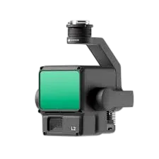
ZENMUSE L2
Price may exclude taxes and shipping · Subject to change
Overview
The DJI Zenmuse L2 is a next-generation integrated LiDAR and RGB camera payload designed for high-performance aerial surveying, precision mapping, and detailed 3D modeling. Combining a high-density LiDAR sensor with a 20MP RGB camera and tight GNSS/IMU synchronization, the Zenmuse L2 delivers rapid point cloud capture, true color imagery, and accurate geospatial data in a single flight. Built for professional UAV mapping missions, it streamlines data collection for topographic surveys, forestry analysis, infrastructure inspection, and volumetric measurement.
Product Description
The DJI Zenmuse L2 is a next-generation integrated LiDAR and RGB camera payload designed for high-performance aerial surveying, precision mapping, and detailed 3D modeling. Combining a high-density LiDAR sensor with a 20MP RGB camera and tight GNSS/IMU synchronization, the Zenmuse L2 delivers rapid point cloud capture, true color imagery, and accurate geospatial data in a single flight. Built for professional UAV mapping missions, it streamlines data collection for topographic surveys, forestry analysis, infrastructure inspection, and volumetric measurement.
Product Details
Category: Payloads
Subcategory: General
Availability: In Stock