

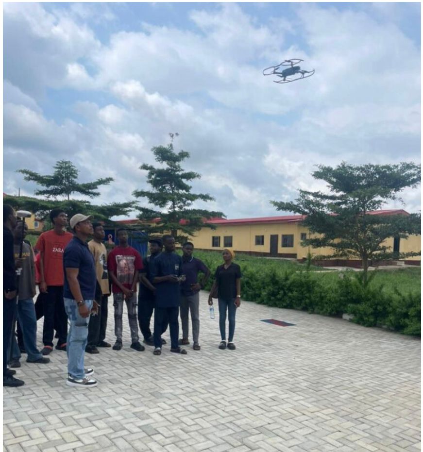
The path to becoming a licensed Surveyor in Nigeria is structured and challenging. It includes a five-year university degree, two years of pupillage, and professional registration. During this time, you gain basic knowledge in surveying principles. You also get practical experience that builds your technical skills and helps form key professional relationships. But in a time of fast changes in technology and methods, is this early training enough for long-term success? Surveying curricula are designed based on the knowledge and technology available at a particular time. This means that what was relevant five or ten years ago may not fully equip today’s professionals. Also, how we do surveys and projects keeps changing. The main principles stay the same. But tools now offer better speed, accuracy, and efficiency. To remain relevant, every Surveyor must embrace continuous learning. The difference between an average and an exceptional professional often lies in their commitment to growth. To maintain a competitive advantage, try these strategies:
First, build a habit of curiosity. Think often about ways to improve. Ask questions like:
- Are there better ways to do this task?
- What new tools are changing the field?
- What software works best now?
- What sources give me regular industry updates?
This habit helps you adapt quickly.
Second, focus on personal growth. Make time for training that builds your skills. Do this by:
- Adding it to your monthly or yearly goals.
- Finding trusted platforms for the skills you need.
- Investing in paid resources. These often come from close networks and give big value. Skipping them to save money can slow your progress.
Third, grow your professional network. Strong connections help share knowledge and advance your career.
tart by:
- Joining groups and communities in your field.
- Forming ties with mentors and peers. They offer support and new ideas. These links can create unexpected chances.
Finally, take action and adapt. Meet new technologies with openness, not fear. Do this by:
Seeing first-time challenges as chances to learn and get better.
Taking every opportunity to gain skills and improve.
OTIC Geosystems trainings are a great way to gain key skills in Surveying and Geospatial intelligence. Our programs show you new technologies. They teach software for easy data handling and display. They also help you stay useful as the industry changes.
With these skills, you can complete projects with the accuracy and new ideas of today's professionals. Our courses include but are not limited to GNSS, Leveling, Total stations, Drone mapping, 3D laser scanning, Bathymetric surveys, etc. Ready to level up?To learn more about our trainings and stay updated: Follow us on YouTube: [(http://www.youtube.com/@oticgeosystems)] Connect on LinkedIn: [https://www.linkedin.com/otic-geosysytems-limited)]
Contact us directly: 08100277870, 07081427221, 07032165401, or 07061769934 Your career growth is waiting. Start today!
Where to buy GPS in Nigeria Handheld
GPS devices are essential tools for surveyors, farmers, engineers, environmental teams, outdoor users, and anyone managing projects worth millions of naira, especially since the government has directed all capital projects above ₦150 million to submit GPS coordinates for compliance. Many people search online for where to buy GPS in Lagos, where to buy Garmin GPS in Nigeria, or best handheld GPS for surveying, and still end up confused with outdated information and unreliable sellers. This guide explains the top handheld GPS brands in Nigeria, how they perform in real-world use, and the best place to buy them with nationwide delivery.
What Is a Handheld GPS?
A handheld GPS is a compact, battery-powered device that uses satellite signals to determine your exact location on Earth. Unlike mobile phones, handheld GPS units don’t rely on internet service , making them ideal for fieldwork, remote mapping, and outdoor navigation. These devices can record coordinates, measure distance, store waypoints, and guide you back to saved locations with impressive reliability.
Types of Handheld GPS You Can Buy in Nigeria
1.Garmin Handheld GPS (1–3 m Accuracy) Garmin remains the most popular global brand for handheld navigation GPS. Typical accuracy: 1m – 3m Popular Garmin models in Nigeria include: • o Garmin eTrex 32x o Garmin GPSMAP 65s o Garmin GPSMAP 67 o Garmin GPSMAP 76 Garmin devices are excellent for:
- Forestry
- Agriculture
- Boundary checks
- Environmental mapping
- General navigation
- Wildlife tracking
- Security and patrol operations
2.Ruinone Handheld GPS (0.5 m – 2 m Real-World Accuracy) Ruinone is becoming one of the most preferred handheld GPS options because it provides very tight accuracy at an affordable cost. Real-World Accuracy Test for Ruinone (Nigeria – Oct 2025) We carried a series of field checks comparing Ruinone handheld GPS readings to a stable PPP reference coordinate.
- 17th Oct 2025 PPP: N 711999.092, E 558395.321 Handheld: N 711999.570, E 558396.932 Δ: 0.478 m, 1.611 m
- 27th Oct 2025 PPP: N 711999.092, E 558395.321 Handheld: N 711999.676, E 558394.135 Δ: 0.584 m, –1.186 m
- 29th Oct 2025 PPP: N 711999.092, E 558395.321 Handheld: N 711999.635, E 558394.538 Δ: 0.543 m, –0.783 m
What This Means These observations show that Ruinone handheld GPS consistently delivers 0.5 m – 2 m accuracy, making it extremely reliable for Nigerian users who need, GIS mapping, Farm mapping, Boundary checks etc.
3.Wangan Handheld GPS Wangan GPS devices offer rugged, mid-range handheld options for mapping and navigation tasks in Nigeria. They are commonly used by:
Survey assistants
Agricultural field teams
Forestry officers
Extension workers Typical accuracy range: 1m – 3m If you need a trusted source, OTIC Geosystems is a leading supplier of handheld GPS units, GNSS receivers, GIS mapping tools, and field equipment. We deliver nationwide to: Lagos, Abuja, Port Harcourt, Kano, Kaduna etc. Your device is shipped safely and comes tested and ready for the field.
Why People Prefer Buying from Geossotech
Buyers choose Geossotech because:
- Verified suppliers
- Nationwide delivery
- Tested and calibrated units
- Warranty support
- Free consultation on the right device for your work
- Access to Garmin, Ruinone, Wangan, Wuinone, and more
- Extensive trainings
- Excellent after sales support
You can purchase:
Handheld GPS
GNSS RTK receivers
Total Stations
GIS tablets Accessories and batteries
How to Order Your Handheld GPS Today
To buy your handheld GPS in Nigeria, send a WhatsApp message to OTIC Geosystems [https://wa.me/2349048332623](https://wa.me/2349048332623) Request a quote and availability, Get delivery across all states in Nigeria .You can now shop confidently, knowing each device explained here has real performance data and field validation. Visit oticgs.com to explore our range of handheld GPS devices or contact our sales team to help you choose the best model for your next project.
Tripods, Poles & Tribrach’s: Why Accessories Define Accuracy, Not Just Receivers Accuracy Starts Below the Receiver
Every surveyor wants sub-centimeter precision. We invest heavily in high-end GNSS receivers, robotic total stations, and laser RTK systems. Yet the silent accuracy killers often aren’t the receivers themselves but the tripods, poles, and tribrachs that hold them up. These accessories are the foundation of every measurement. If they flex, vibrate, or tilt even slightly, the data you capture becomes compromised. At OTIC Geosysytems, we have seen well-calibrated GNSS rovers produce inconsistent results due to poor accessory setup.
.
Let’s break down why these overlooked tools are just as important as the receiver they support.
1.Tripods — The Ground Truth of Stability A tripod does more than hold equipment; it defines the stability of your entire measurement system. Field tests show that tripod vibration or movement as small as 1 mm at the top can translate to several centimeters of error on long baselines. Key Considerations:
- Material: Aluminum tripods: Lightweight, good for fast setups, but expand slightly under heat.
- Fiberglass tripods: Great for electrical isolation and moisture resistance, perfect for Nigeria’s humid climate.
- Wood tripods: Best vibration absorption but heavier; suitable for static setups.
- Height & Locking:
- Adjustable legs with strong clamps prevent sinking on soft or wet ground.
- Choose tripods with dual clamps for extra stability during GNSS base setup.
- Bubble & Head Design: A misaligned bubble causes the receiver to tilt, throwing off coordinate alignment. opt for precision bubbles with ≤ 8′ sensitivity and a flat head for modern GNSS units.
- Pro Tip: Always tap each tripod leg after setup. If the bubble shifts, it’s not stable enough.
2. Poles — The Accuracy Multiplier A survey pole defines how your rover’s height is calculated. Even a 2 mm error in pole height can shift your GNSS coordinate by 5–8 mm vertically. What to Look For:
- Material Strength: Carbon fiber poles are light and strong, ideal for RTK work where mobility matters. Aluminum poles are cost-effective but can warp over time if not calibrated.
- Height Consistency: Collapsible poles must lock tightly; loose clamps can change the measured height during field movement. Bubble Calibration: A pole’s circular bubble should be calibrated regularly; a simple misalignment leads to tilted data collection.
3. Tribrachs — The Unsung Precision Component:The tribrach ensures your total station, laser, or base receiver stays perfectly centered over a known point. A poor-quality tribrach can shift alignment by several arcseconds, enough to affect angular precision in control networks. Choose Wisely:
- Centering Accuracy: Prefer tribrachs with ≤ 0.5 mm optical plummet accuracy.
- Locking Mechanism: Metal spring locks last longer than plastic ones under heat.
- Calibration: Check periodically with a known reference point; a few minutes of preventive care saves hours of rework.
Pro Tip: When pairing a tribrach with a GNSS base, always check bubble sensitivity and retighten the leveling screws after 10–15 minutes of sunlight exposure.
Why Accessories Are the Real Accuracy Investment
Most surveyors upgrade receivers for accuracy, but the receiver is only as reliable as the hardware beneath it. Investing in quality accessories gives:
- Better repeatability for control points and CORS setups
- Less downtime from unstable setups or broken clamps
- Improved data confidence, essential when bidding for engineering contracts
At OTIC Geosystems, we have observed that teams using quality tripods and poles achieve 25 – 40 % higher point repeatability than those using generic accessories. So, whether you are setting up a GNSS base or a total station, the right accessories ensure your readings remain consistent all day. Expert Insight — Accuracy Begins from the Ground Up In modern surveying, accuracy is a chain; receiver, accessories, software, and operator skill all link together. A weak tripod or uncalibrated pole is like a cracked foundation in an expensive building: everything above it fails, no matter how advanced your receiver is. So, before your next project, check the smallest components of your setup. Because when your foundation is strong, precision becomes effortless. Shop Tested Accessories at Geossotech Geossotech provides a full range of tripods, poles, tribrachs, and calibration services designed for Nigeria’s unique conditions. All accessories are tested for seamless performance and guaranteed fit. Call/WhatsApp: +234 (07061769934) for pricing or demo.