
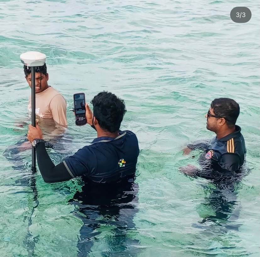
From Positioning to 3D Reality Capture

PART 1
What Is GNSS Surveying? Understanding GPS, RTK and Modern Positioning
GNSS surveying is the use of satellite positioning systems to determine accurate geographic positions for surveying, mapping, construction and other geospatial applications. From the development of GPS to today’s multi-constellation GNSS receivers and real-time kinematic (RTK) systems, satellite positioning has fundamentally changed how surveyors establish coordinates and collect field data.
What is GNSS?
GNSS stands for Global Navigation Satellite System. It is the broader term for satellite positioning constellations such as GPS, Galileo, GLONASS and BeiDou.
A GNSS receiver observes signals from multiple satellites and uses measurements such as pseudorange and carrier phase to determine its position.
Modern receivers can use several constellations simultaneously, increasing the number of available observations and improving positioning availability in many environments.
What is the difference between GPS and GNSS?
GPS is one satellite navigation system operated by the United States.
GNSS is the general term for satellite navigation systems collectively.
Therefore, saying a modern survey receiver is a “GPS receiver” can be technically incomplete. A contemporary multi-constellation receiver may simultaneously use GPS, Galileo, GLONASS and BeiDou.
What is RTK surveying?
RTK, or Real-Time Kinematic positioning, improves GNSS positioning by using correction information from a reference station or correction service.
Instead of relying only on the satellite observations received by the rover, RTK uses carrier-phase measurements and correction information to resolve positioning much more precisely.
This is why RTK GNSS has become important for applications such as boundary surveys, construction setting-out, topographic surveys and control establishment.
What affects GNSS accuracy?
The equipment alone does not determine the final accuracy.
Satellite geometry, atmospheric conditions, multipath, obstructions, correction quality, observation time, antenna setup, coordinate reference systems and field procedures can all affect results.
Professional GNSS practice therefore requires attention to both equipment and methodology.
Where is GNSS surveying used?
GNSS is used for:
* Topographic and cadastral surveying
* Construction setting-out
* Geodetic control
* Infrastructure development
* Mapping and GIS data collection
* Agriculture and precision farming
* Deformation and monitoring applications
* Positioning aerial survey sensors
What are its limitations?
GNSS requires suitable satellite visibility and can be affected by buildings, vegetation, multipath and other obstructions. It is also not always the appropriate tool for precise measurements where satellite signals are unavailable or where direct line-of-sight measurement is required.
This is why modern surveying is increasingly about choosing the right technology for the measurement problem, rather than replacing one instrument with another.
OTIC GEOSYSTEMS provides professional GNSS positioning solutions for surveying, engineering, construction, agriculture and other geospatial applications, supporting users with equipment, training and technical solutions.
Up next
A GNSS receiver can determine a position, but where do its corrections come from? In Part 2, we examine CORS networks and the reference infrastructure behind modern GNSS positioning.
Look out for Part 2: What Is a CORS Network?
EMMANUELLA IGWE
BUSINESS DEVELOPMENT EXECUTIVE
+971568597708