

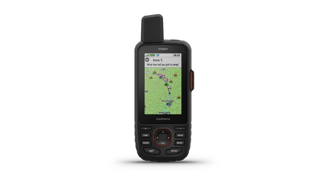
Handheld GPS devices remain essential tools for construction companies, oil & gas operations, engineers, surveyors, and GIS professionals who require reliable field navigation, mapping, and data collection. Whether you’re doing route reconnaissance, inspections, environmental assessments, or general field navigation, choosing the right handheld GPS ensures accuracy, durability, and efficiency on every project. Below are the top handheld GPS devices you should consider in 2025 including Garmin, RuniOne, Wanggan, and SinoGNSS data collectors along with exactly where to buy them. Garmin Handheld GPS; Rugged, Reliable & Field-Proven Garmin remains the world’s most trusted brand for handheld GPS devices. Beyond the simple eTrex series, Garmin offers advanced, high-performance handheld units suitable for demanding field conditions.
Garmin GPSMAP Series (64/65/66/67): The GPSMAP family is one of Garmin’s strongest performers. With multi-GNSS tracking (GPS, GLONASS, Galileo), large colour displays, strong reception under canopy, and rugged construction, GPSMAP units are ideal for heavy field use. Best for:
- Construction and engineering site checks
- Pipeline inspections Road, rail & infrastructure routes
- Environmental mapping & GIS work
Garmin Montana Series (600/700 Series): The Montana series offers a big touchscreen, high battery capacity, multi-GNSS support, and the ability to switch between handheld and in-vehicle mounting Best for:
- Oil & gas field operations
- Drone support teams
- Mining & quarry mapping
- Large construction site
Garmin Foretrex Series (Foretrex 601/701): A hands-free, wrist-mounted GPS unit with multi-GNSS and long battery life. Portable and perfect for teams that move fast.
- Best for: Field scouts S
- ecurity and patrol operations
- Quick coordinate capture
- Route logging Garmin eTrex Series (10, 22x, 32x) Basic & Compact
Although one of Garmin’s simplest handheld options, the eTrex remains a rugged, portable device for basic GPS tasks like waypoint management, route navigation, and simple mapping. Students, environmental teams Quick checks Backup handheld GPS on surveying jobs.
RuniOne Handheld GNSS / Data Collectors – Rugged GIS & Mapping Devices RuniOne produces durable Android-based handhelds and GNSS-enabled data collectors designed for professional fieldwork. These devices combine the convenience of a smartphone interface with advanced GNSS tracking, making them suitable for mapping, GIS, and surveying workflows.
Key features:
- Rugged, waterproof hardware
- Android OS for mapping apps (QField, FieldGenius, ArcGIS, etc.)
- Strong GNSS performance
- Large battery and bright screen
Best for:
- GIS teams
- Survey assistants
- Utility inspections
- Asset mapping
Wanggan Handheld GNSS Land Meters; Affordable GPS Units Wanggan (and similar budget GNSS meters) offer cost-effective handheld units for simple field tasks like area measurement, boundary tracing, and quick point marking. Best for: Agriculture Small contractors Quick boundary checks Non-precision mapping They provide good value for money and are ideal when high accuracy isn’t required SinoGNSS Data Collector (e.g., R50); Professional Survey-Grade Field Controller For professionals who need more than basic handheld GPS capabilities, the SinoGNSS R50 is a high-performance data collector designed for real surveying and mapping.
Why SinoGNSS R50 stands out:
Rugged Android-based survey controller Large 5.5” sunlight-readable screen
Supports GPS, GLONASS, BeiDou, Galileo Runs surveying software (FieldGenius, Survey Master, etc.) IP67 waterproof & drop-resistant 7000mAh battery for all-day fieldwork This device is perfect when you need serious data collection, integration with GNSS/RTK receivers, or professional surveying workflows
Best for: Surveyors Construction layout teams Oil & gas pipeline alignment
Topographic mapping Cadastral work Utility mapping (water, telecom, power) The R50 goes far beyond basic handheld GPS units, it is built for precision, durability, and high-volume field data. Where to Buy Handheld GPS & Data Collectors in Nigeria (and Worldwide)
1. OTIC Surveys: OTIC is a major supplier of surveying and mapping equipment. They stock Garmin handheld GPS, RuniOne handhelds, Wanggan GNSS meters, SinoGNSS data collectors, and full RTK GNSS systems. Why buy from OTIC Surveys: Nationwide delivery Worldwide shipping Strong after-sales support Repairs, setup & training Specialists in surveying, GIS & construction equipment
2. OTIC GEOSYSTEMS: OTIC Geosystems supplies a wide range of survey, engineering, and construction tools including handheld GPS units, GIS devices, GNSS receivers, Data collectors, and full surveying kits. They serve a wide range of professional clients across Nigeria.
Why buy from OTIC Geosystems: Technical consultations for choosing the right device Fast shipping & reliable stocking Supports surveyors, engineers, construction firms & oil/gas companies International deliveries available Which Should You Choose? For rugged field navigation: Garmin GPSMAP or Montana For affordable GPS tasks: Wanggan For GIS and mapping: RuniOne For professional surveying: SinoGNSS R50 or similar data collectors For basic tasks: Garmin eTrex And no matter the device you choose, OTIC Surveys and OTIC Geosystems remain the best places to buy these handheld GPS units, with reliable support, fast delivery, and training for field teams in Nigeria and worldwide.