

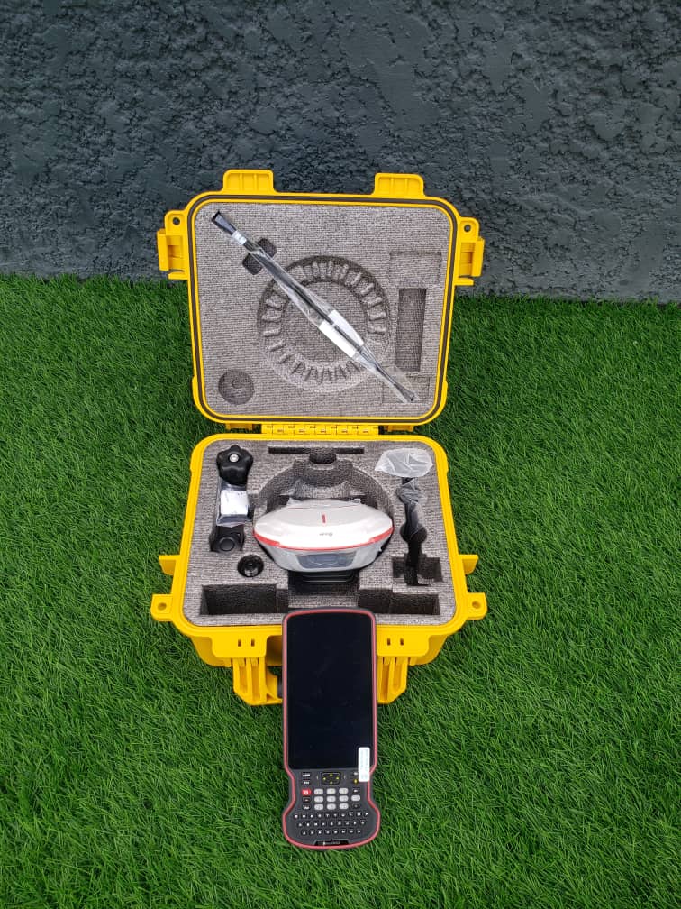
Surveyors across the United Arab Emirates, United Kingdom, Australia, South Africa, Angola, Benin Republic, Namibia, Tanzania, Zimbabwe, Sierra Leone, Ghana, Malawi, Egypt and other countries need GNSS equipment that delivers accuracy, precision, reliability and efficiency without unnecessarily increasing project costs. The SinoGNSS T20 GNSS Receiver is designed to provide a compact and cost-effective RTK surveying solution for professionals working in different environments.
What Makes the SinoGNSS T20 Different?
The SinoGNSS T20 receiver uses the SinoGNSS K8 high-precision module, with 1,590 channels and support for GPS, GLONASS, BeiDou, Galileo, QZSS, IRNSS and SBAS. It is designed for full-constellation and full-frequency tracking, helping surveyors maintain reliable satellite positioning across different working environments.
The receiver supports RTK, Static, Fast Static, Long Observation Static, DGPS and SBAS surveying modes. Its RTK initialization time is specified at less than 10 seconds, with an initialization reliability of at least 99%.
High Precision Without the High Cost
For surveyors, purchasing professional GNSS equipment is not only about specifications, it is also about value for money. A cost-effective GNSS receiver can help surveying businesses control equipment investment while still delivering the precision required for professional projects.
The T20 provides stated RTK accuracy of 8 mm + 1 ppm horizontally and 15 mm + 1 ppm vertically, while static and fast-static accuracy can reach 2.5 mm + 0.5 ppm horizontally and 5 mm + 0.5 ppm vertically, under the manufacturer's specified conditions.
This combination of accuracy, portability and cost-effectiveness can make the SinoGNSS T20 an attractive option for surveyors handling construction, topographic, cadastral, mapping and engineering projects.
Work Anywhere with a Compact GNSS Receiver
The T20 weighs approximately 670 g and has a slim 48 mm profile, making it easier to carry and operate throughout a working day. It also provides up to 20 hours of typical working time and supports charging in less than five hours.
Its 60° IMU tilt compensation allows surveyors to collect measurements without always holding the pole perfectly vertical, with the specification indicating up to 2.5 cm tilt-survey accuracy.
The receiver is also rated IP67 for water and dust protection and can survive a 2 metre drop onto concrete, making it suitable for demanding field environments.
Strong Compatibility for Different Surveying Workflows
The T20's datalink is described as compatible with mainstream brands, while its supported correction formats include RTCM 2.x, RTCM 3.x, CMR and CMR+.
This compatibility can help surveyors integrate the receiver into different GNSS workflows instead of being restricted to one equipment ecosystem.
Why Do Surveyors Prefer the SinoGNSS T20?
The combination of high-precision GNSS, 1,590 channels, 60° IMU compensation, long battery life, rugged construction, mainstream-brand compatibility and compact design makes the T20 a versatile surveying tool.
For surveyors in the United Arab Emirates, United Kingdom, Australia, South Africa, Angola, Benin Republic, Namibia, Tanzania, Zimbabwe, Sierra Leone, Ghana, Malawi, Egypt and beyond, the T20 can support modern field surveying while keeping equipment investment in consideration.
OTIC Wants Your GNSS Feedback
At OTIC GEOSYSTEMS, we want to hear directly from surveyors around the world.
Whatsapp : +971 52 622 8783
Email: info@oticgs.com
What GNSS receiver do you currently use in your country? What challenges do you experience? Is your GNSS accurate and reliable? Do you experience correction, connectivity, battery, software or after-sales support issues?
Your feedback will help OTIC better understand the real challenges facing surveyors and identify where SinoGNSS T20 can provide a practical, accurate and cost-effective alternative.
Tell us your country, your GNSS brand and the biggest challenge you face. Let's build better surveying solutions together.