

If you are a surveyor, you already know that choosing the right GNSS receiver can make a big difference to your daily work. Whether you are surveying a residential estate in the United Arab Emirates, setting out a road in Ghana, mapping farmland in Australia or working on a construction project in the United Kingdom, you need equipment that delivers reliable positioning, saves time and fits your budget.
But does getting advanced surveying technology mean you must spend a fortune?
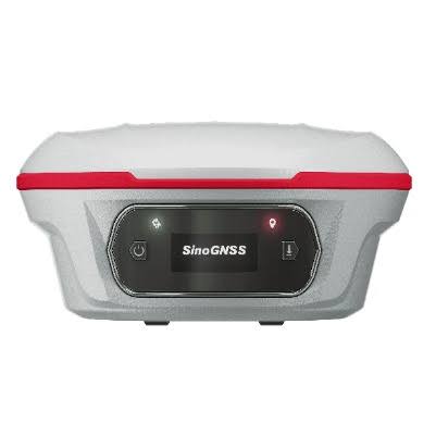
Not necessarily! The SINOGNSS Jupiter Laser RTK is an advanced GNSS surveying solution that offers surveyors a combination of GNSS positioning, laser measurement and tilt compensation designed to make fieldwork easier, particularly improve productivity across construction, land surveying, infrastructure development when working on demanding projects.
OTIC GEOSYSTEMS is helping surveyors across the globe to discover this technology handles challenging survey points with greater flexibility and share their experiences with us.
What Makes the SINOGNSS Jupiter Laser RTK Different from other GNSS brands?
Imagine working on a construction site where a wall, fence or other obstacle prevents you from placing your survey pole directly over a point. Traditionally, you might need to find another approach, reposition yourself or spend additional time collecting the measurement.
With the SINOGNSS Jupiter Laser RTK, its laser measurement capability can help you capture points that are difficult to access directly. Its integrated visual technology and tilt compensation also support more flexible surveying workflows.
Some of its key specifications include:
GNSS tracking: 1,668 channels support including GPS, GLONASS, BeiDou, Galileo, QZSS, IRNSS and SBAS.
Laser measurement: Up to 50 metres, allowing surveyors to measure inaccessible or obstructed points.
RTK positioning accuracy: Approximately 8 mm + 1 ppm horizontally and 15 mm + 1 ppm vertically under specified baseline RTK conditions.
Tilt compensation: Integrated IMU supporting measurements at up to 120° tilt, with specified accuracy of 2.5 cm.
Visual technology: Integrated dual cameras for visual positioning and stakeout workflows.
Connectivity: Bluetooth, Wi-Fi, USB Type-C and supported UHF radio options.
Battery performance: Up to 16 hours under specified operating conditions.
Rugged design: Approximately 810 g with internal battery, designed for demanding outdoor work.
These features can help surveyors work more efficiently on land surveys, topographic mapping, road construction, property development and engineering projects.
Benefits for Surveyors Across Global Markets
From the United Arab Emirates and United Kingdom to Australia, South Africa, Angola, Benin Republic, Namibia, Tanzania, Zimbabwe, Sierra Leone, Ghana, Malawi and Egypt, surveyors need dependable equipment that balances accuracy, productivity and cost.
The SINOGNSS Jupiter Laser RTK helps address these demands in land surveying, road construction, property development, mining, infrastructure projects and topographic mapping.
Its laser measurement capability allows operators to survey points that are difficult or unsafe to reach directly. Tilt compensation reduces the need to keep the survey pole perfectly vertical, while visual stakeout tools support efficient point identification and positioning.
For large projects, these features can help reduce unnecessary movement, repeat measurements and fieldwork delays, improving overall operational efficiency.
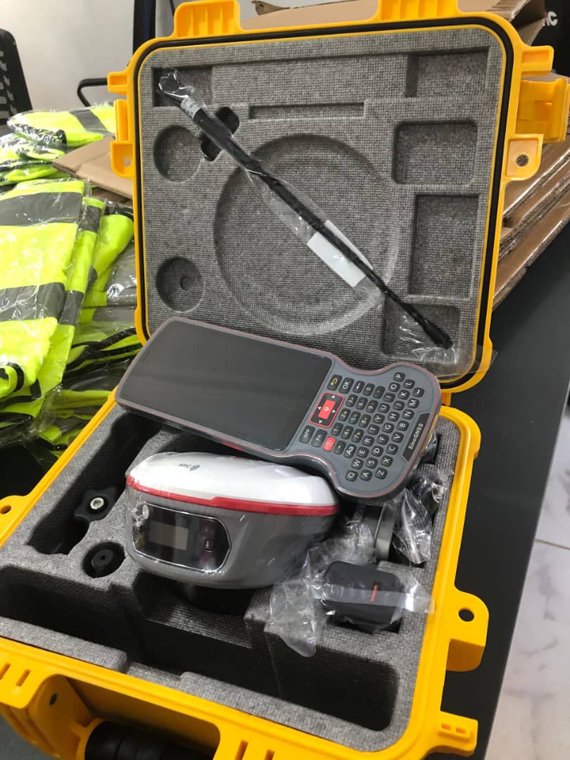
Can the SINOGNSS Jupiter Laser RTK Work With Leica, Trimble, Topcon, Sokkia and other GNSS Brands?
This is an important question for surveyors who already own equipment from established brands.
The good news is that SINOGNSS Jupiter Laser RTK surveying workflows can support equipment from different manufacturers when compatible correction formats, communication settings and software are used.
For example:
Leica: A surveyor using a Leica GNSS base station or network correction service can be able to use compatible RTCM corrections with the SINOGNSS Jupiter Laser RTK, subject to the supported configuration.
Trimble: Where the existing Trimble setup supports compatible RTCM correction output, the SINOGNSS Jupiter Laser RTK can be integrated into a suitable mixed-brand RTK workflow.
Topcon and Sokkia: Surveyors using these systems can also be able to share compatible network corrections or correction data with the SINOGNSS Jupiter Laser RTK, depending on receiver capabilities and configuration.
The same principle can apply to other GNSS brands, including CHCNAV, Hi-Target, Tersus, Emlid and Stonex.
However, confirm the relevant model specifications, correction formats, coordinate reference system and communication requirements before combining equipment.
Another advantage is flexibility; you do not need to replace your entire existing surveying setup to explore another GNSS solution.
Why Consider SinoGNSS Jupiter Laser RTK for Large Projects?
Surveyors often compare GNSS receivers based on accuracy, usability, compatibility, after-sales support and total ownership cost. The SinoGNSS Jupiter Laser RTK stands out through its combination of laser measurement, integrated cameras, tilt compensation and multi-constellation satellite tracking in one receiver. These capabilities can help reduce unnecessary repositioning, improve access to difficult points and support more efficient field operations.
Its flexible correction-data and communication options can support integration into existing workflows, subject to compatible software, protocols and configurations. Surveyors should confirm inter-operability with their current receivers, controllers and correction services before purchasing. Its affordability also makes it worth evaluating for surveying businesses that want advanced features without automatically committing to premium priced equipment.
For professionals seeking advanced feature yet budget-conscious alternative, OTIC GEOSYSTEMS can provide product information and assistance in selecting a suitable configuration.
OTIC GEOSYSTEMS Wants to Hear From You!
We believe the best surveying solutions begin with listening to the people who use them every day.
Which GNSS brand are you currently using? Is it Leica, Trimble, Topcon, Sokkia, CHCNAV, SINOGNSS or another brand? What do you like about your current receiver, and what would you improve?
Would you consider the SINOGNSS Jupiter Laser RTK for your next surveying project if its features, compatibility and price met your needs?
Interested in the SinoGNSS Jupiter Laser RTK?
Contact OTIC GEOSYSTEMS today:
WhatsApp: +971 52 622 8783
Email: info@oticgs.com
Upgrade your surveying workflow with a practical combination of precision, laser technology and field productivity. Let's make surveying more efficient, accessible and productive. Shop from our website https://oticgs.com/shop