
Choosing the right RTK GNSS receiver for land surveying is crucial for surveyors who need accurate measurements and reliable on-site results. In Nigeria, where land acquisition, property development, road construction, and infrastructure projects are ongoing across states, the right surveying equipment makes a difference. Whether you are carrying out a cadastral survey in Lagos, a topographic survey in Rivers State, or setting out a construction project in Abuja, you need equipment you can depend on. One option worth considering is the SinoGNSS N5 Receiver, manufactured by ComNav Technology (ComNavTech) and supplied in Nigeria by OTIC Geosystems.
What Makes the SinoGNSS N5 a Good GNSS Receiver for Surveying?
The SinoGNSS N5 combines RTK positioning, multi-constellation satellite tracking, IMU tilt compensation, and flexible communication options. Here are some of the features that make it suitable for professional surveying.
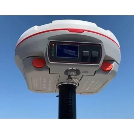
Clear OLED Display

SinoGNSS N5 with OLED Display
The built-in OLED screen makes it easy to check receiver information and operating status, even under bright sunlight, without constantly relying on a data collector.
2. Flexible Communication Range
The N5 supports different communication options for surveying operations:
Internal UHF: Up to 10 km practical working range.
Internal GSM/4G: Around 40 km using SIM-based internet corrections.
CORS Network RTK: Up to 150 km where suitable correction coverage is available.
Actual distances depend on terrain, network coverage, and operating conditions.
3. Strong GNSS Tracking Under Canopy
With 1,198 tracking channels and support for multiple satellite constellations, the N5 is designed to maintain reliable positioning in challenging environments, including areas with partial tree canopy.
4. IMU Tilt Compensation
Its calibration-free IMU tilt technology allows surveyors to collect points without keeping the pole perfectly vertical. This is useful around walls, fences, and building corners.
5. Rugged Design and Hot-Swappable Batteries
The N5 features an IP67-rated body for dust and water protection. Its hot-swappable batteries allow replacement without switching off the receiver, keeping fieldwork running with minimal interruptions.
6. Easy-to-Use Survey Master Software
The N5 works with ComNav's Survey Master software, which offers a straightforward interface for topographic surveys, point collection, stakeout, area measurement, and other common surveying operations.
SinoGNSS N5 in Nigeria: Where Surveyors and Companies Are Using It. The SinoGNSS
The N5 SinoGNSS receiver has gained acceptance among surveying professionals and companies in different parts of Nigeria, with Abuja currently leading in sales, recording 50 units purchased through OTIC Geosystems.
In Port Harcourt, Rivers State, companies such as Rainbow Heritage Group and Unitts Services are among the organizations using the SinoGNSS N5. Several individual surveyors have also purchased the receiver and are enjoying its performance in their surveying operations.
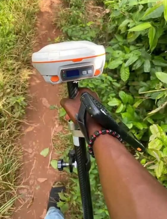
SinoGNSS N5 Receiver with a customer in Rivers State, Port Harcourt
Get Your SinoGNSS N5 from OTIC Geosystems.
OTIC Geosystems is a supplier of ComNavTech surveying equipment in Nigeria, providing product guidance, technical support, training, and after-sales services.
Whether you are in Abuja, Port Harcourt, Lagos, or another part of Nigeria, contact us to inquire about the SinoGNSS N5 pricing and enjoy free delivery to any state in Nigeria.
Looking to upgrade your surveying equipment?
Talk to OTIC Geosystems today:
Click here to message on WhatsApp.
Phone: +234 904 833 2623
Email: info@oticgs.com
Visit OTIC Geosystems or explore our product shop.