

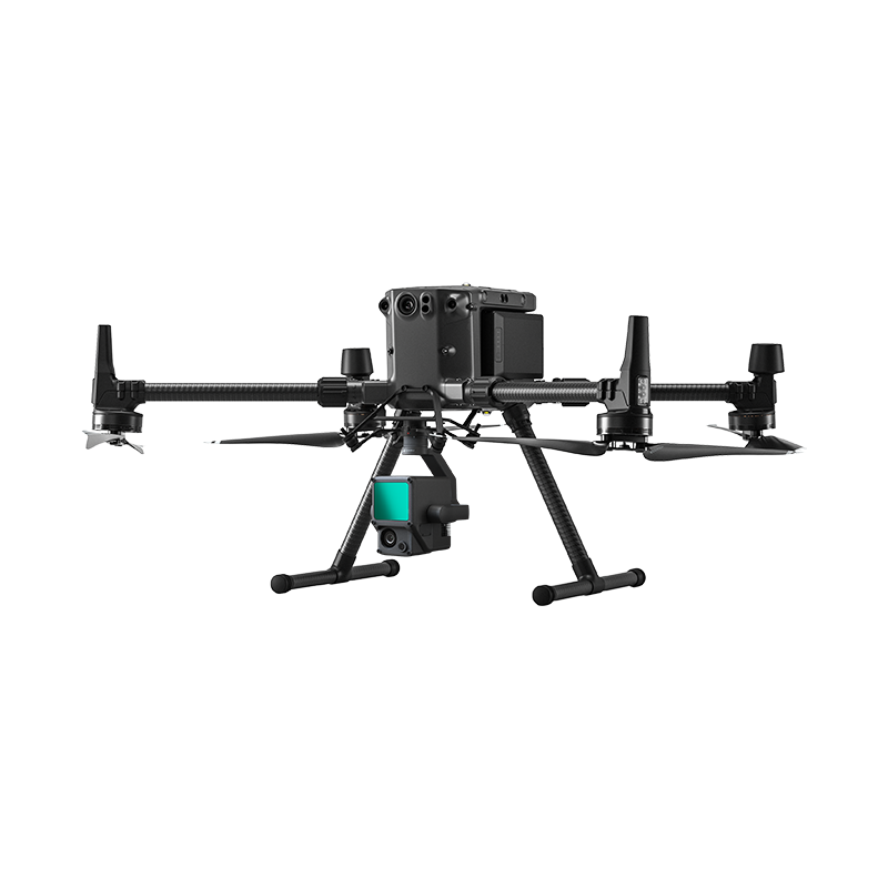
The DJI Matrice 300 RTK Drone
When you think of a drone built to handle real work tough conditions, long hours, heavy payloads, The DJI Matrice 300 RTK Drone immediately comes to mind. This isn’t your average flying camera. It’s a high performance, enterprise grade aerial platform that’s fast becoming the go to for professionals across surveying, mapping, utilities inspection, public safety, and more. The DJI Matrice 300 RTK is one of the most reliable and powerful enterprise drones available today. Trusted across industries from surveying to inspections and public safety, it offers outstanding performance, intelligent features, and flexibility to support the most demanding fieldwork. OTIC Geosystems is proud to supply and support the DJI Matrice 300 RTK for professionals across Nigeria. Our service includes technical consultation, field support, training, and nationwide delivery.
Built to Perform Where it Matters Most
The Matrice 300 RTK is engineered for real world applications where performance, safety, and data accuracy cannot be compromised.
Key Flight & Performance Specs: Battery Life / Flight Time: Up to 55 minutes Allows extended mapping missions and inspections with fewer takeoffs and landings, increasing efficiency.
Maximum Takeoff Weight: 9 kg Handles heavier sensor payloads including LiDAR scanners, full-frame cameras, and more. Maximum Payload Capacity: Approx. 2.7 kg Supports a wide range of sensors, including multi-gimbal setups for complex projects.
Single Gimbal Damper Max Payload: 930 g
Perfect for heavier individual sensors like the Zenmuse L1 or H20T.
Ingress Protection Rating (IP Rating): IP45 Water- and dust-resistant; suitable for deployment in rain, wind, and construction sites.
Operating Temperature Range: -20°C to 50°C Built for Nigeria’s varying climates from dry northern zones to humid coastal regions.
RTK Accuracy Where It Counts: The built-in RTK module (Real-Time Kinematic) enhances your drone’s GNSS positioning, delivering survey grade accuracy even in challenging environments.
RTK Accuracy: Horizontal: ±1 cm + 1 ppm Vertical: ±1.5 cm + 1 ppm This level of precision is essential for: Engineering surveys GIS data acquisition Construction progress tracking Corridor mapping (roads, pipelines, utilities) The M300 RTK works with leading global navigation systems: GPS GLONASS BeiDou Galileo This ensures strong satellite coverage even in remote or urban settings.
Obstacle Avoidance & Safety Systems: Safety in flight is a top priority—especially when flying near structures or over active work zones.
Six-Directional Obstacle Sensing: Detects objects from all directions—up, down, front, back, left, and right. Positioning System: Combines vision sensors and infrared for stable hovering in GPS-denied environments.
Smart Return-to-Home (RTH): Calculates safe paths and automatically returns when the mission is complete or battery runs low. This technology helps protect your drone and improves safety for your field crews.
**Payload Flexibility That Adapts to Any Job** The M300 supports multiple gimbal and sensor configurations. Whether you're capturing visuals, scanning terrain, or analyzing heat loss, there's a compatible payload. Supports: Single and Dual Gimbal Setups LiDAR Payloads (Zenmuse L1) Photogrammetry Cameras (Zenmuse P1) Thermal & Zoom Sensors (Zenmuse H20T) This makes it ideal for diverse applications: Topographic mapping Environmental surveys Oil & gas infrastructure inspection Powerline and solar panel monitoring Disaster response and search & rescue
Smarter Workflow for Faster Results: The Matrice 300 RTK isn’t just powerful—it’s smart. AI Spot Check: Repeat shots across multiple flights for consistent inspections. Waypoint 2.0: Predefine flight routes with dozens of waypoints and camera actions. Smart Track: Automatically follow moving subjects like vehicles or equipment. Dual-Operator Mode: One pilot can control the drone, while another manages the camera—perfect for complex missions. These features cut down on human error and reduce processing time, especially for drone service providers delivering client-ready data.
Why Buy from OTIC Geosystems?: OTIC Geosystems is more than just a supplier, we’re a field partner for professionals who need dependable equipment and support. We provide:
✅ Genuine DJI drones with warranty
✅ Expert setup and configuration
✅ Field training for teams and pilots
✅ Technical advice on payload selection
✅ After-sales support and servicing
✅ Nationwide delivery and field demos We serve clients in surveying, GIS, engineering, construction, utilities, and emergency services across Nigeria.
Ready to Take Flight? The DJI Matrice 300 RTK is in stock and available now at OTIC Geosystems. Whether you're upgrading your tools or launching a new drone department, we’ll help you succeed with the right hardware and support. 📞 Call: +234 706 176 9934 📧 Email: [oticgs@gmail.com] Location: No. 3, Bello Close, Chevyview Estate, Chevron Drive, Lekki-Epe Expressway Lagos, Nigeria.