

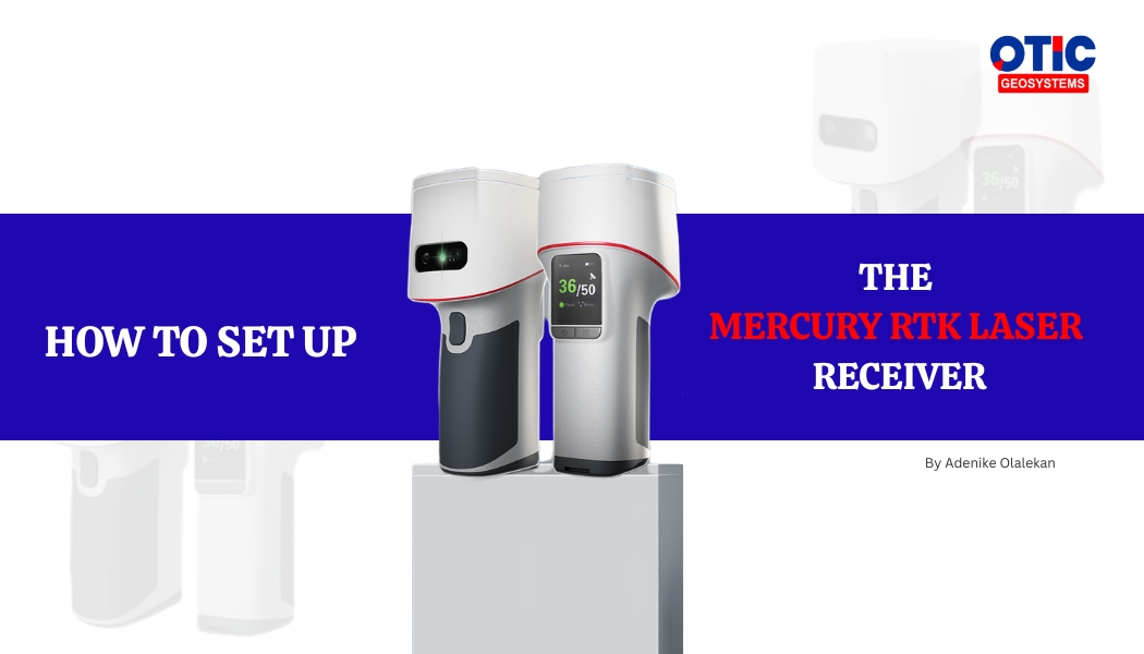
Surveying technology is evolving rapidly, and modern GNSS receivers are making fieldwork faster, smarter, and more flexible than ever before. One of these innovations is the Mercury RTK Laser Receiver; a handheld GNSS surveying device designed to simplify data collection while maintaining high accuracy.
In this guide, we’ll walk through how to set up and use the Mercury RTK Laser Receiver for efficient GNSS surveying without constantly relying on a data logger in the field.
What is the Mercury RTK Laser Receiver?
The Mercury RTK Laser Receiver is a handheld GNSS surveying device equipped with laser measurement capabilities, camera-assisted targeting, IMU calibration, and RTK positioning technology.
One of its major advantages is that after the initial setup process, surveyors can carry out field measurements directly with the receiver itself without needing to move around with a data logger or survey pole continuously.
This improves mobility, convenience, and efficiency during field operations.
Step 1: Connect the Receiver to the Data Logger
Before starting any survey, the receiver must first be connected to the data logger in order to:
• Create a survey project
• Configure the coordinate system
• Set the work mode
• Establish RTK correction settings
To begin:
1. Navigate to the Project Page on the Mercury receiver.
2. Click on New
3. A barcode/QR code will appear on the receiver screen.
4. Open the Survey Master Application on the data logger.
5. Click the QR code scanner icon located at the top-right corner of the screen.
6. Scan the barcode displayed on the GNSS receiver.
Once scanned successfully, the receiver and data logger are connected.
Step 2: Create a New Survey Project
After connection:
1. Enter a project name.
2. Select the appropriate coordinate system.
Once completed, save the project settings.
Step 3: Configure RTK Correction Settings
To achieve precise positioning accuracy, the Mercury receiver must be configured for RTK corrections.
The setup process includes:
Navigating to the ROV section
Creating a new work mode
Selecting Internal GSM as the data link type
Choosing the CORS protocol
Since the receiver uses its internal SIM card and hotspot connection, the Internal GSM option allows it to receive correction data directly without depending on the data logger throughout the survey.
Next:
1. Enter the CORS login credentials.
2. Download the source list.
3. Select the preferred base station.
4. Save and apply the work mode.
Once connected successfully, the receiver achieves a Fixed RTK Solution, indicating high-accuracy positioning.
Step 4: Enable Laser and Camera Features
One of the standout features of the Mercury RTK Laser Receiver is its laser-assisted surveying capability.
After setup:
• Swipe down from the top of the screen
• Turn on the laser feature
The receiver also includes a built-in camera view that displays exactly where the laser is pointing. This helps surveyors target precise locations quickly and accurately.
Step 5: Select Survey Mode
The Mercury receiver supports multiple survey modes, including:
Point Survey
Used for capturing individual points.
Polyline Survey
Automatically connects measured points with lines.
Polygon Survey
Creates enclosed polygon shapes for area measurements.
Laser Ranging
Allows measurements using laser targeting functionality.
These options make the receiver highly versatile for different surveying applications.
Step 6: Initialize the IMU
Before taking measurements, the IMU (Inertial Measurement Unit) should be calibrated for better accuracy.
To initialize:
• Shake the receiver gently back and forth
• Continue until the laser calibration bar becomes full
This process improves measurement stability and accuracy.
Step 7: Capture Survey Points
Once calibration is complete:
1. Aim the laser at the desired survey location.
2. Press the survey button on the receiver.
The Mercury receiver captures the point instantly.
Additional points can then be measured continuously without needing the data logger.
Step 8: View and Manage Survey Data
The receiver allows users to:
• View captured points
• Display coordinates in different formats
• Switch between coordinate systems
• Delete unwanted points
This provides a complete handheld surveying workflow directly from the receiver.
Advantages of the Mercury RTK Laser Receiver
The Mercury RTK Laser Receiver offers several advantages for surveyors and geospatial professionals:
• Portable handheld surveying
• No need for continuous data logger usage
• Laser-assisted point targeting
• Camera visualization
• RTK fixed accuracy
• Multiple survey modes
• Faster field operations
• Reduced equipment handling
The Mercury RTK Laser Receiver is designed to improve efficiency, flexibility, and convenience in modern GNSS surveying workflows. By combining RTK positioning, laser targeting, IMU technology, and handheld portability, it allows Surveyors to complete accurate field measurements with less equipment stress and greater mobility.
For Surveyors looking to modernize their workflow, handheld GNSS surveying technology like the Mercury RTK Laser Receiver represents a major step forward in geospatial data collection.