

If you are a surveyor, engineer, geospatial scientist, GIS professional, or anyone who uses GNSS equipment for positioning and data collection, you've probably come across the term "CORS."
CORS networks have transformed the way professionals carry out high-accuracy GNSS positioning. Instead of setting up a temporary GNSS base station at every project site, users can connect their GNSS rover to an existing CORS network through the internet and receive real-time correction data.
But what exactly is CORS? How does it work? And most importantly, how do you connect your GNSS receiver to a CORS network?
In this guide, we'll take you through the process, from understanding CORS and NTRIP to configuring your GNSS receiver and confirming that you are receiving RTK corrections.
One important thing to remember: the exact buttons, menu names, and terminology may differ from one GNSS brand to another. The process, however, follows the same basic principle.
What Is CORS?
CORS stands for Continuously Operating Reference Station.
A CORS is a permanently installed GNSS reference station positioned at a precisely known location. The station continuously tracks signals from GNSS satellites and provides reference data that can be used to improve positioning accuracy.
When several CORS stations are connected, they form a CORS network.
Instead of physically establishing your own GNSS base station at a project site, your rover can receive corrections from this existing reference infrastructure.
In simple terms:
Traditional RTK
Your Base Station → Corrections → Your Rover
CORS Network RTK
CORS Network → Internet/NTRIP → Your Rover
This can make field operations more efficient because you don't necessarily have to establish and manage a temporary base station for every RTK survey.
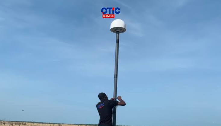
OTIC Surveys has described CORS as a network of permanently installed GNSS base stations that continuously receive satellite signals and provide real-time correction data to users. Here!
How Does a CORS Work?
A CORS station continuously observes GNSS satellite signals from its known position.
The correction information generated from the reference infrastructure is then made available through a network.
For real-time users, correction data is commonly delivered using NTRIP.
Your GNSS rover connects to the internet, communicates with an NTRIP caster, and receives an appropriate correction stream.
The basic workflow looks like this:
GNSS Satellites
↓
CORS Reference Stations
↓
CORS Network
↓
NTRIP Caster
↓
Internet
↓
GNSS Rover
↓
RTK Solution
Your rover combines the satellite observations it is receiving with the correction information supplied by the CORS network to calculate its position.
What Is NTRIP?
If you're learning about CORS for the first time, NTRIP is another term you'll encounter frequently.
NTRIP stands for:
Networked Transport of RTCM via Internet Protocol.
Simply put, NTRIP is a method for transmitting GNSS correction data over the internet. Your GNSS receiver acts as an NTRIP client. It connects to an NTRIP caster, authenticates your account where required, and receives the correction stream from the CORS network. This is why CORS and NTRIP are often mentioned together.
CORS provides the reference infrastructure.
NTRIP provides the communication method for delivering correction data to your GNSS rover over the internet.
Why Do Professionals Use CORS?
CORS can be useful for a wide range of GNSS applications, including
Land surveying
Engineering surveying
Construction
GIS data collection
Mapping
Cadastral operations
Infrastructure development
Road projects
Agriculture
Geospatial research
Positioning and field data collection
The major advantage is that the user can access an existing reference network rather than establishing a temporary base station for every project.
This can mean:
Faster field setup
Less time spent establishing and configuring a temporary base station.
Network RTK corrections
Receive correction data directly through an internet connection.
Greater operational flexibility
Work across a broader area where suitable CORS coverage and network connectivity are available.
Convenient workflow
Once your GNSS receiver is configured correctly, reconnecting to the CORS service can be a relatively simple part of your field workflow.
What Do You Need to Connect to a CORS Network?
Before connecting your GNSS receiver, you'll generally need:
1. An RTK-compatible GNSS receiver
Your receiver needs to support network RTK/NTRIP.
OTIC Geosystems states that its CORS network uses the standard NTRIP protocol and supports modern NTRIP-compatible GNSS receivers, including brands such as SinoGNSS, Leica, Hi-Target, and Gintec.
2. A field controller
You'll need the controller or data collector and the appropriate surveying software.
3. Internet access
Your rover or controller must have internet access to communicate with the NTRIP caster.
This could be through:
A SIM card in the GNSS receiver
A SIM card in the controller
Mobile hotspot
Wi-Fi
Another supported internet connection
4. A CORS account
You need an account with your chosen CORS service.
5. NTRIP connection details
Depending on the CORS provider, you may need:
Server/caster address
Port
Username
Password
Mountpoint
How to Connect Your GNSS Receiver to a CORS Network
Now that you understand what CORS and NTRIP are, let's look at the actual connection process.
Step 1: Register for a CORS Account
First, you need access to a CORS network.
If you want to use OTIC CORS, you can register through the OTIC CORS portal:
After completing your registration and activating the required service, you'll have the account information needed to configure your receiver.
Step 2: Make Sure Your GNSS Receiver Has Internet
Your GNSS receiver needs an active internet connection to receive corrections through NTRIP.
Depending on your equipment, you may use:
GNSS receiver SIM → Internet → CORS
or
Controller SIM → Internet → CORS
or
Mobile hotspot → Controller/Receiver → CORS
Before troubleshooting your CORS settings, confirm that your device can actually access the internet.
Remember:
Having internet access does not automatically mean you are connected to CORS.
The receiver must still establish an NTRIP connection and receive correction data.
Step 3: Open Your Rover Settings
Open the surveying software connected to your GNSS receiver.
Look for the section that controls your rover's correction or data connection.
Depending on the GNSS manufacturer, you might see:
Data Link
NTRIP
NTRIP Client
Network RTK
Internet RTK
RTK Corrections
Internet Data Link
Correction Data
This is where terminology can become confusing.
A SinoGNSS receiver may not use the same terminology as a Leica receiver.
Don't worry if your screen looks different.
You're looking for the function that allows your rover to receive RTK correction data through the internet.
Step 4: Enter Your CORS Connection Details
Once you've located the NTRIP or Network RTK settings, enter the information provided by your CORS provider.
Typically, you'll find fields similar to
Setting | What It Means |
|---|---|
Name | Name of CORS (OTIC CORS) |
IP Address / Caster | Address of the NTRIP server |
Port | Communication port |
Username | Your CORS account |
Password | Your account password |
Mountpoint | Correction stream you want to receive |
Terminology may differ between receivers, but the information serves the same purpose.
Step 5: Retrieve the Mountpoints
Some GNSS controllers have an option such as
Source list with a download icon
Get Mountpoint
Get Source Table
Source Table
Refresh
or
Mountpoint List
This allows your receiver to retrieve the correction streams available from the NTRIP caster.
Step 6: Select the Appropriate Mountpoint
A mountpoint identifies the correction stream that your GNSS rover will receive.
A CORS provider may offer several mountpoints.
The appropriate one can depend on:
Your location
Your GNSS receiver
The correction service
The network configuration
Your project's requirements
If you're unsure which mountpoint to select, contact your CORS provider before starting your survey.
Step 7: Connect
After entering your connection details and selecting your mountpoint, select the equivalent of
Connect
Start
Apply
or another similar option.
Your GNSS receiver will then attempt to connect to the NTRIP caster.
If successful, the controller should indicate that the connection is active and correction data is being received.
Step 8: Confirm Your RTK Solution
This is a very important step.
NTRIP Connected does not automatically mean RTK Fixed.
Your receiver may display solution statuses such as:
Single → DGPS → RTK Float → RTK Fixed
For high-accuracy RTK applications, you should confirm that your receiver has achieved the appropriate RTK solution before collecting final survey observations.
You should also carry out the appropriate field checks, including verification against known control where required by your project.
Your GNSS controller may also display:
Number of satellites
Correction age
PDOP
Horizontal accuracy
Vertical accuracy
RTK status
RTCM data
These indicators help you assess the quality of your GNSS solution.
Why Does the Setup Look Different on My GNSS Receiver?
This is probably the most important thing to understand when following CORS tutorials online.
The process can be similar even when the screens look completely different.
For example:
Receiver A | Receiver B |
|---|---|
NTRIP Client | Internet RTK |
Data Link | Correction Data |
Caster | Server |
Get Mountpoint | Source Table |
Connect | Start |
So don't focus only on finding the exact words used in a tutorial.
Instead, identify the function:
Internet → NTRIP → Login → Mountpoint → Corrections → RTK
That's the general workflow.
OTIC CORS: Expanding GNSS Correction Coverage Across Nigeria
OTIC is building a growing CORS network designed to provide network RTK correction services to professionals working with GNSS technology.
Our network currently operates 34 CORS stations, with the network continuing to expand.
34+ Active CORS Stations Across 25 States
The goal is simple:
Make reliable GNSS correction services more accessible to professionals working across Nigeria.
Who Can Use OTIC CORS?
Everyone
What If OTIC CORS Doesn't Cover My Area?
CORS coverage continues to expand.
If you need CORS coverage in a location where there isn't currently a suitable station, OTIC also provides a Request a CORS Station option.
You can indicate the location where additional GNSS correction coverage would be useful, and OTIC can evaluate it as part of its ongoing network expansion.
Common CORS Connection Problems
My receiver cannot connect to CORS.
Check:
Internet connection
Server/caster address
Port
Username
Password
Mountpoint
Make sure the information you're entering matches what your CORS provider supplied.
I am connected but still getting RTK Float
An NTRIP connection alone does not guarantee an RTK Fixed solution.
Check:
Satellite visibility
Correction data
Correction age
Mountpoint
Internet stability
Environmental obstructions
GNSS observation conditions
I can't see any Mountpoints
First, check your internet connection and caster information.
If everything appears correct but the mountpoint list is still unavailable, contact your CORS provider to confirm that your account and correction service are active.
My receiver keeps disconnecting
An unstable internet connection can interrupt NTRIP correction delivery.
Check the mobile network at your project location and confirm that your receiver or controller maintains a stable internet connection.
Register for OTIC CORS and connect your compatible GNSS receiver to the network.
Register for OTIC CORS
For CORS coverage enquiries, compatibility questions, or assistance with your setup, contact the OTIC Geosystems team.
OTIC Geosystems
📞 +234 904 833 2623
📧 info@oticgs.com
💬 WhatsApp: +234 904 833 2623
Coming Next: How to Connect Different GNSS Brands to OTIC CORS
We've covered the general process of connecting a GNSS receiver to a CORS network.
But there's another question we hear often:
“Where exactly do I find these settings on my GNSS receiver?”
That's what we'll cover in the next episode.
We'll move from the general CORS process to brand-specific CORS setup.
Stay tuned for Episode 2: How to Connect Your GNSS Receiver to OTIC CORS — Brand by Brand.