

What is CORS?
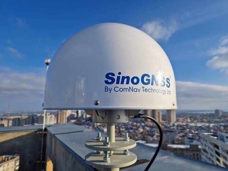
CORS (Continuously Operating Reference Stations) are permanent GNSS base stations located at accurately known positions. These stations continuously receive satellite signals and broadcast real-time correction data to GNSS rovers, improving their positioning accuracy from several meters to centimeters. CORS networks are typically managed by government agencies, universities, and private companies, and serve as the backbone for real-time and post-processed high-accuracy GNSS applications.
How CORS Positioning Enhances Accuracy
1.Mitigation of GNSS Signal Errors CORS stations detect and correct for errors in GNSS signals caused by satellite orbit inaccuracies, clock drift, and atmospheric conditions. This ensures far more reliable positioning data.
2.Differential GNSS (DGNSS) Enhancements Through real-time or post-processed corrections, CORS allows GNSS receivers to achieve sub-meter or centimeter-level accuracy using differential techniques.
3.Real-Time Kinematic (RTK) Support RTK-enabled GNSS rovers connected to a CORS network can achieve centimeter-level accuracy in real-time, transforming surveying, agriculture, and construction workflows.
4.Precise Point Positioning (PPP) CORS stations contribute data to global networks that support PPP, allowing standalone receivers to achieve high precision positioning even in remote areas.
5.Long-Term Stability and Monitoring CORS networks form the basis for long-term geodetic monitoring, supporting deformation analysis, tectonic studies, and infrastructure stability assessments.
Significant Changes Enabled by CORS – Global and Nigerian Context Globally:
CORS networks have revolutionized precision positioning across industries:
Agriculture: Precision farming techniques using RTK GNSS have increased crop yield and reduced input waste.
Construction and Engineering: Machine control systems rely on CORS data to achieve millimeter-grade accuracy in earthworks.
Autonomous Vehicles: CORS-based corrections are critical for lane-level navigation.
Geoscience: Crustal deformation, sea-level monitoring, and post-seismic analyses are now more precise and continuous.
In Nigeria: Nigeria has seen several transformative developments due to CORS networks, including: NIGNET: (Nigerian GNSS Reference Network) is a national CORS infrastructure established by the Office of the Surveyor General of the Federation (OSGOF) to support geodetic control, cadastral surveys, and national mapping efforts. In 2024, this network was further strengthened with the installation of a COR Station by OTIC Surveys at the OSGOF headquarters.
Surveying and Mapping: Local surveyors now perform RTK-based surveys with cm-level accuracy, significantly reducing time and cost.
Land Administration and Boundary Resolution: CORS supports more accurate property boundary mapping, aiding urban planning, reducing disputes, and improving land titling systems.
Infrastructure Development: Projects like rail lines, bridges, and roads increasingly depend on high-precision positioning for layout and monitoring. Disaster Management and
Monitoring: CORS contributes to floodplain mapping and deformation monitoring in regions prone to environmental risks.
OTIC Geosystems / OTIC Surveys Role in CORS Solutions: OTIC Geosystems plays a pivotal role in advancing CORS-enabled accuracy in Nigeria by: Deploying and maintaining high-precision CORS infrastructure across the country Offering CORS services to surveyors, farmers, construction firms, and other industries Providing training for geospatial professionals on integrating CORS technology into their workflows Collaborating with both government and private sector entities on the installation and application of CORS systems OTIC Geosystems is the top leading provider of CORS network in Nigeria having installed 15 COR Stations in 10 states in Nigeria, expanding the coverage and accessibility of real-time, high-accuracy positioning solutions. OTIC Geosystems' solutions ensure that users across Nigeria can access reliable, real-time positioning for smarter and more accurate geospatial applications.
Reference:OSGOF (Office of the Surveyor General of the Federation) – [nignet.osgof.gov.ng](http://nignet.osgof.gov.ng) FIG Working Week 2013 – Establishment of Nigerian CORS for Sustainable Development GEOSON Conferences and publications