

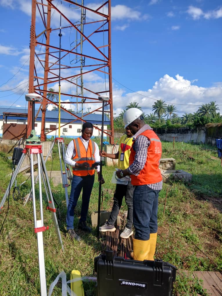
In modern surveying, photogrammetry, and drone mapping, accuracy depends heavily on well-planned Ground Control Points (GCPs) and Checkpoints. You must understand that both are crucial for ensuring accuracy; they serve distinct but complementary purposes. Understanding the difference between the two is essential for producing reliable, verifiable, and high-precision results when it comes to modern surveying, photogrammetry, and drone mapping.
What Are Ground Control Points (GCPs)?
Ground Control Points (GCPs) are known and accurately surveyed points placed on the ground that are visible in aerial images or LiDAR scans and are used to orient and scale the drone data, ensuring accuracy. They are used during data processing to georeferenced and align imagery to real-world coordinates.
Purpose:
- Anchor the aerial imagery or point cloud to the correct coordinate system and datum.
- Correct for distortions caused by camera angle, terrain, or flight altitude.
- Improve absolute positional accuracy of the final map or 3D model.
How They Work
- Surveyors mark GCPs on the ground (e.g., painted targets, tiles, or panels).
- Each GCP’s X, Y, Z coordinates are measured using GNSS or a total station with high accuracy.
- During processing (e.g., in Pix4D, Agisoft Metashape, or DroneDeploy), the software matches the visible GCPs in the images to their known coordinates.
- The dataset is then georeferenced to fit those ground-truth points. GCPs ensure that your orthomosaic, digital surface model, or 3D model is accurately aligned in both horizontal and vertical dimensions, typically achieving centimeter-level accuracy.
What Are Checkpoints
Checkpoints are independent surveyed points used to validate the accuracy of your processed model or map. They are not included in the data processing; instead, they serve as quality control points.
Purpose:
- Evaluate how accurate the georeferenced data really is.
- Provide a statistical measure of mapping accuracy (e.g., RMSE—Root Mean Square Error).
- Verify whether GCPs and processing have achieved the desired positional tolerance.
How They Work
A few ground points are surveyed with the same accuracy as GCPs.These points are not added to the processing workflow.
After processing, their measured (ground) coordinates are compared to the coordinates derived from the model. The difference (error) indicates how close the dataset is to the true ground reality. Checkpoints quantify absolute accuracy. For example: If your GCPs were accurate to ±2 cm, but checkpoints show RMSE = 0.03 m, then your model has an overall positional accuracy of 3 cm.
Best Practices
- Plan GCPs strategically: place them around corners, edges, and varying elevations of the project area.
- Keep checkpoints separate: Never use the same point as both GCP and Checkpoint.
- Ensure visibility: Use high-contrast targets that stand out in imagery.
- Survey accurately: Use RTK GNSS or Total Station for all control measurements.
Use a sufficient quantity:
- Small projects: fewer than or exactly 5 GCPs + 3 checkpoints.
- Large/mixed terrain: More GCPs, especially near elevation changes.
In short, GCPs are used to georeference your dataset to make your map accurate, while checkpoints are used to validate your dataset and prove your map is accurate. Together, they ensure both spatial integrity and data credibility in modern surveying and mapping.
Interested in Drone Mapping Training? Take your surveying skills to the next level with our Hands-On Drone Mapping Training 2.0. Learn how to plan flights, collect aerial data, set Ground Control Points (GCPs), process orthomosaics, and achieve survey-grade accuracy with GNSS and drone technology. 📍 Training Mode: Physical 📅 Date: 13th – 14th November, 2025 📞 Enquiries & Registration: +2347032165401, +2348167743787, +2347063073317 📲 Follow Us: @oticsurveys ✉️ Email: [sales@oticsurveys.com](mailto:sales@oticsurveys.com)