

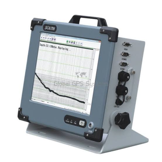
The United Arab Emirates (UAE) has an extensive coastline, major ports, offshore developments, artificial islands, canals, and marine infrastructure. With continued investment in coastal construction, dredging, ports, marine transportation, and offshore projects, the demand for skilled hydrographic surveyors in the UAE continues to grow. Modern echo-sounders are among the most important technologies supporting accurate underwater surveying.
An echo-sounder is a hydrographic surveying instrument that uses sound waves to measure water depth. The equipment transmits a sound pulse toward the seabed and measures the time required for the signal to return. This information allows surveyors to determine water depth and create accurate underwater maps.
Why Echo-Sounders Are Important for UAE Surveyors
For professionals working in bathymetric surveying in the UAE, accurate depth information is essential. Surveyors use echo-sounders to identify seabed elevations, underwater features, channels, and potential hazards. This information supports safe navigation, dredging operations, marine construction, and coastal development.
Hydrographic survey equipment is particularly important around locations such as Dubai, Abu Dhabi, Sharjah, and major port and coastal developments. Accurate bathymetric data can help engineers and project managers make informed decisions before construction or dredging begins.
Single Beam and Multibeam Echo-Sounders
Different projects require different types of echo-sounders. A Single Beam Echo Sounder (SBES) measures depth directly beneath the survey vessel and can be an effective solution for basic bathymetric surveys, channel surveys, and depth verification.
A Multibeam Echo Sounder (MBES) collects multiple depth measurements across a wide swath of the seabed. This enables surveyors to generate detailed 3D representations of underwater environments and is highly valuable for large-scale hydrographic surveys, dredging, port development, and offshore projects.
Understanding how to configure, operate, calibrate, and process data from these systems is an important skill for professionals seeking hydrographic surveying jobs in the UAE.
Develop Your Hydrographic Surveying Skills
Technical knowledge alone is not enough. Hydrographic survey training helps surveyors understand echo-sounder setup, sound velocity, vessel positioning, data acquisition, quality control, seabed mapping, and survey data processing.
Combining echo-sounder expertise with GNSS, RTK, GIS, and marine positioning skills can give UAE surveyors a stronger professional advantage. Employers increasingly value professionals who can operate multiple technologies and contribute effectively throughout a surveying project.
Build a Competitive Career in UAE Hydrographic Surveying
For surveyors looking to secure an excellent surveying job in the UAE, developing practical experience with modern hydrographic survey equipment can significantly strengthen their professional profile. Knowledge of echo-sounders, bathymetric data collection, GNSS positioning, and survey software demonstrates the ability to handle specialized marine projects.
At OTIC GEOSYSTEMS, we support surveying professionals with hydrographic equipment, technical guidance, training, and geospatial solutions designed to improve field capability and project performance.
Ready to strengthen your hydrographic surveying skills?
Contact OTIC GEOSYSTEMS for professional guidance on echo-sounders, bathymetric surveying equipment, hydrographic survey training, and marine surveying solutions.
📧 Email: info@oticgs.com
Gain the skills. Master the technology. Stand out in the UAE surveying industry.