

The United Arab Emirates (UAE) is a global leader in infrastructure development, smart cities, transportation, land management, and digital transformation. As ambitious projects continue to reshape the country's landscape, the demand for highly skilled surveying professionals has never been greater. To meet these industry demands, survey training has become essential for equipping surveyors, engineers, GIS professionals, and students with the practical knowledge required to use modern geospatial technologies effectively.
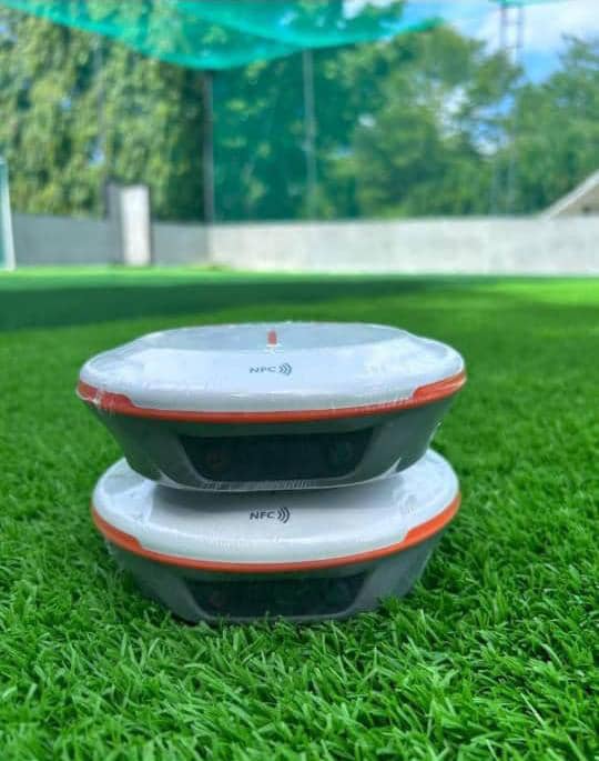
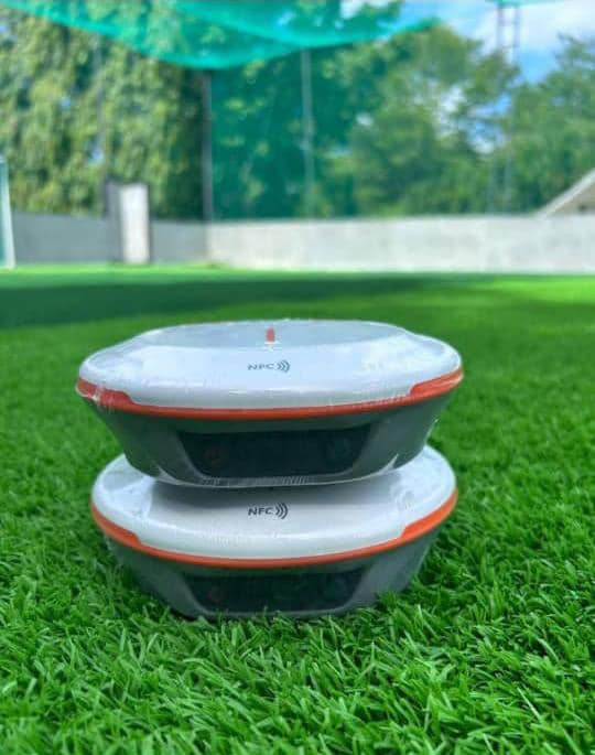
One of the most sought-after training programs is GNSS receiver training, where participants learn to operate Global Navigation Satellite System (GNSS) equipment for precise positioning. Using satellite constellations such as GPS, GLONASS, Galileo, and BeiDou, surveyors can achieve centimeter-level accuracy for cadastral, engineering, construction, and mapping projects. Practical training covers receiver setup, base and rover configuration, RTK surveying, data collection, troubleshooting, and best field practices.
Beyond GNSS, professionals also benefit from GIS training, which teaches the collection, analysis, and visualization of spatial data for urban planning, environmental monitoring, and asset management. Drone (UAV) survey training enables surveyors to capture high-resolution aerial imagery for topographic mapping, construction progress monitoring, and infrastructure inspection. Hydrographic survey training prepares professionals to map ports, coastlines, canals, and offshore environments, supporting marine navigation and waterfront developments. Other valuable training includes Total Station operation, construction surveying, CORS network operation, and survey data processing, all of which strengthen technical competence and improve project outcomes.
Across the UAE, these training programs play a vital role in supporting major infrastructure developments in Dubai, Abu Dhabi, Sharjah, and other emirates. Surveyors apply GNSS, GIS, drone mapping, and hydrographic surveying technologies to support highways, rail projects, commercial developments, utilities, coastal engineering, and smart city initiatives. Continuous training ensures professionals remain competitive while meeting international surveying standards. The importance of survey training extends beyond technical knowledge. Well-trained professionals complete projects more efficiently, reduce costly errors, improve data accuracy, and deliver reliable results that support informed decision-making. Continuous professional development also ensures surveyors stay up to date with the latest surveying technologies, software, and industry best practices.
Survey training is valuable for land surveyors, civil engineers, government authorities, universities, private consulting firms, construction companies, and students preparing for careers in the geospatial industry. Practical, hands-on training builds confidence, enhances productivity, and creates opportunities for career growth in one of the world's most innovative construction and engineering markets.
Apply Your Survey Training with the Right GNSS Technology
Professional survey training provides the knowledge and practical skills needed to succeed, but achieving accurate and reliable results also depends on using high-performance surveying equipment. Whether you've completed GNSS receiver training, GIS training, drone survey training, or hydrographic survey training, working with trusted GNSS receivers allows you to confidently apply your skills on real-world projects.
The United Arab Emirates (UAE) continues to lead the region in infrastructure, construction, transportation, smart city development, and land management. To meet the demands of these projects, surveyors require reliable GNSS technology that delivers speed, precision, and efficiency. SinoGNSS receivers are designed to provide centimeter-level RTK accuracy, fast initialization, multi-constellation satellite tracking, and dependable performance in challenging environments, making them an excellent choice for professionals across the UAE.
If you're looking for a GNSS receiver in the UAE, always purchase from an authorized GNSS distributor or a trusted survey equipment supplier. Buying from a verified partner ensures genuine equipment, a manufacturer-backed warranty, professional user training, calibration services, technical support, software updates, and reliable after-sales service, helping you maximize your investment and perform with confidence on every project.
At OTIC GEOSYSTEMS, we are committed to empowering surveyors, engineers, GIS professionals, construction companies, and government organizations with professional survey training and high-quality SINOGNSS surveying solutions. Our services include equipment supply, hands-on user training, technical support, calibration, and after-sales assistance to help you achieve the highest standards of accuracy and productivity.
Ready to Enhance Your Surveying Capabilities?
Whether you're seeking professional survey training or looking to invest in a GNSS receiver for your next project in the UAE, our team is ready to provide expert guidance and geospatial solutions.
📧 Email: info@oticgs.com
Contact US today and discover how professional survey training combined with advanced SINOGNSS technology can help you achieve greater accuracy, efficiency, and success in every surveying project.